I built
Cloud SURPAC.
Professional surveying, brought into the browser.
I built the calculation engine, interactive workspace and infrastructure that bring it together.
& calculation variants
programs
& point-cloud workspaces
From field observations
to finished deliverables.
The challenge was connecting precise mathematics, specialist workflows and interactive graphics in one usable product.
- 01
Import
Coordinates and field observations.
- 02
Calculate
Positions, geometry and surfaces.
- 03
Review
Results, drawings and 3D views.
- 04
Save
Accepted results and project records.
- 05
Deliver
Plans, reports and export files.
A suite of tools.
One shared workspace.
For land and mine surveyors, engineering teams, CAD technicians and cadastral practitioners.
Survey calculations
From bearings and distances to fixing unknown positions from control and observations.
Coordinate geometry
Join, Polar, Reverse Polar / Eccentric; two sides and included angle; direction–direction, distance–distance, direction–distance and perpendicular intersections.
Curves, areas & traverses
Tangent points, curve information, three-point curve fitting and circle centres; coordinate, polar and fixed areas; off-line and off-circle checks, splays, line running, road apexes, field and data traverses, mass polars, point comparisons and group means.
Least squares & point fixing
Plan, XYZ and height resection; height, plan and spatial intersections; plan trilateration.
Underground mining
Peg determination, observation processing and back checks, with the history behind each result.
- Double Setup
- Double Button
- Double Back Fix
- Peg Files
- Peg Index
- Bord & Pillar Offsets
- Observation Offsets
- Pillar Safety Factor
- Gyro Calibration
- Gyro Reductions
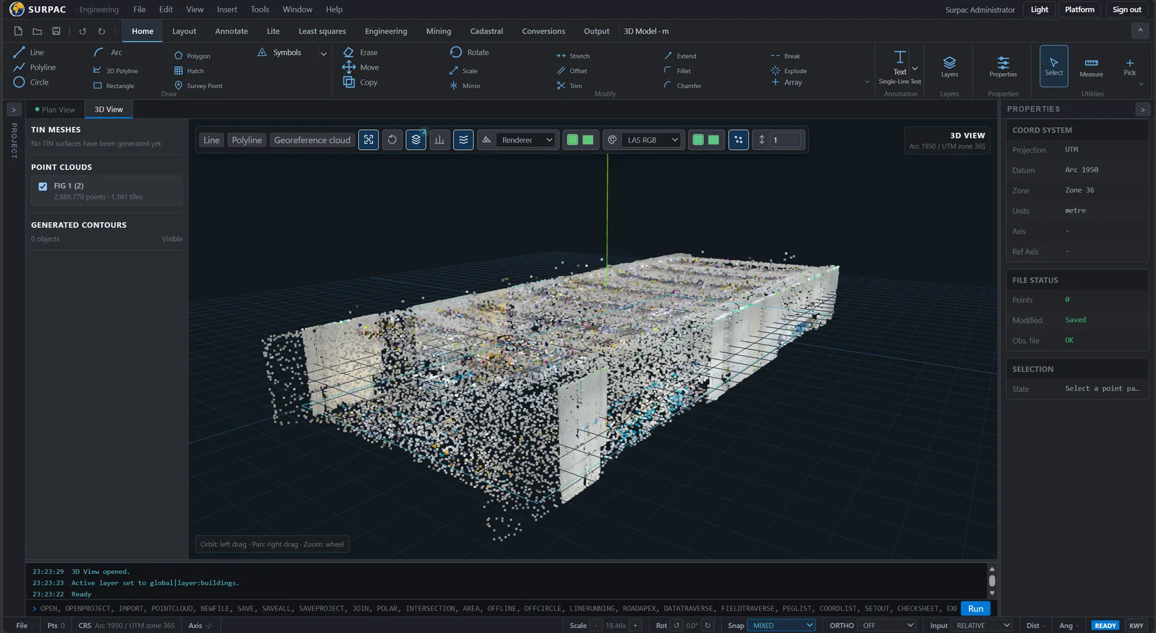
- Point Clouds
Connected checks
Back checks, tolerances, protected error-limit approval and native peg-file import and export.
Terrain & engineering
Terrain models become contours, road alignments, profiles, cross-sections and earthworks quantities.
Terrain
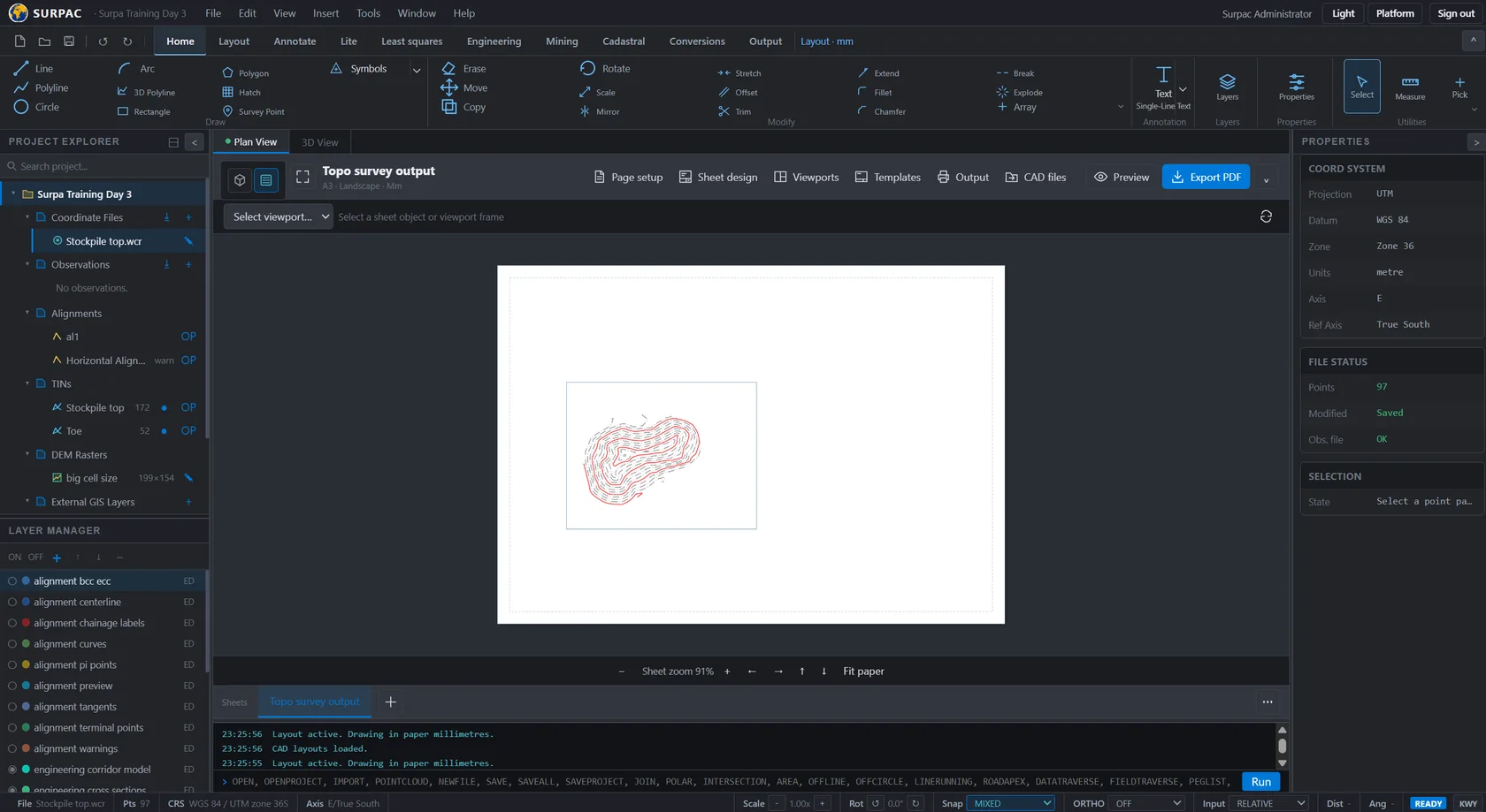
TIN generation and editing, surface boundaries, contours, elevation models, terrain profiles and cut/fill calculations.
Engineering
Horizontal and vertical alignments, sample lines, cross-sections, section views, profiles, volumes and engineering drawings.
3D
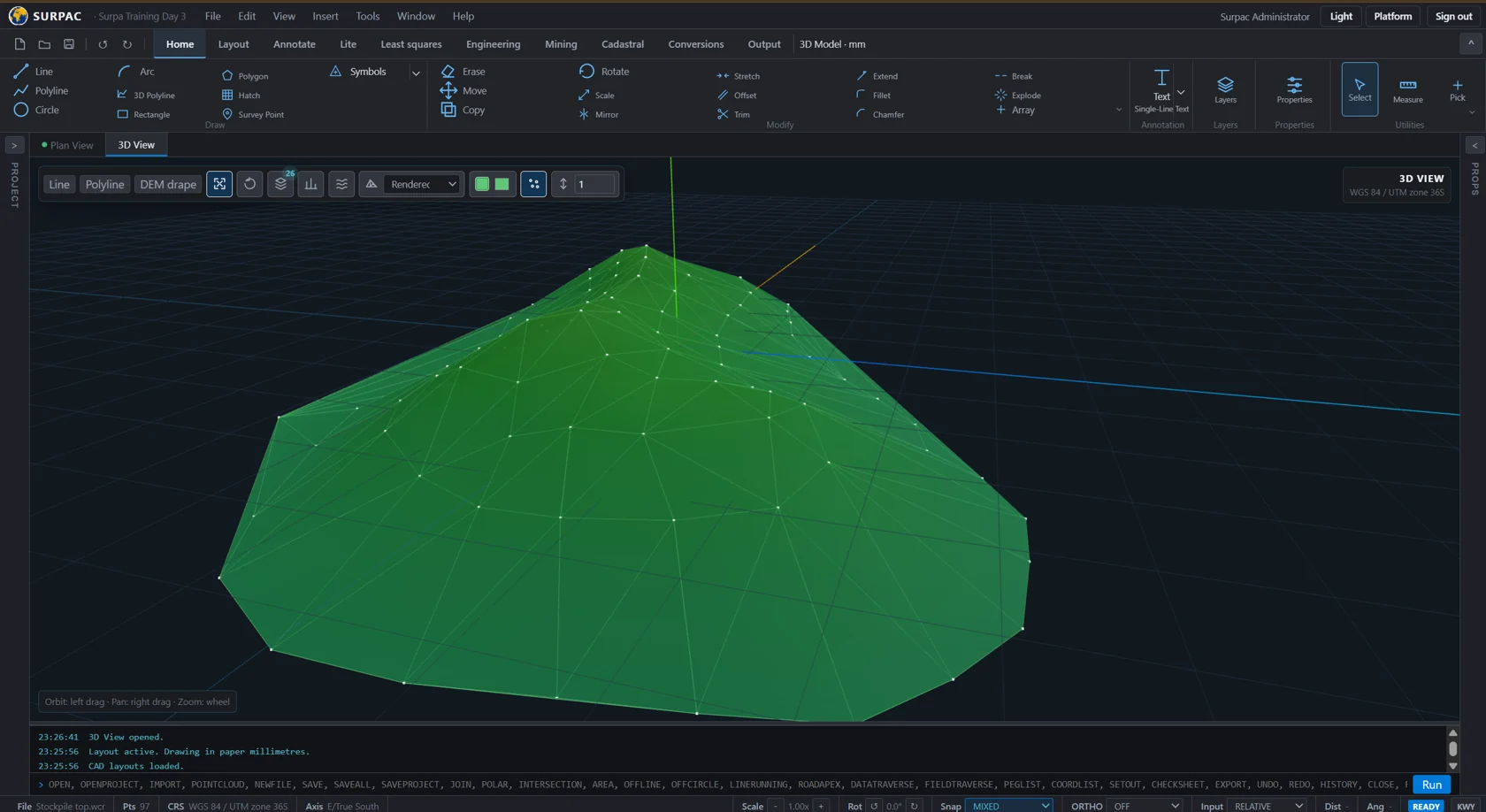
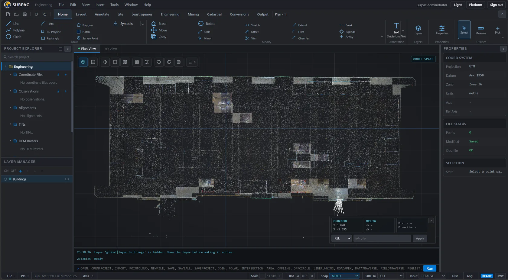
Interactive terrain and spatial-data viewing, point-cloud inspection and project scans.
CAD & drawing production
Draft, annotate and compose drawings in the same workspace as the project’s survey data.
Drafting
Points, lines, polylines, polygons, arcs, circles, text, hatching and images; layers, object snaps and coordinate-based input.
Editing
Move, copy, rotate, scale, mirror, offset, trim, extend, fillet, chamfer, break, explode and arrays.
Deliverables
Sheets, viewports, annotations and plot settings; coordinate and peg listings, setting-out outputs, reports, printing and DXF/DWG export.
Cadastral workspaces
Survey diagrams, parcel plans and jurisdiction-specific documentation workflows.
Plans & diagrams
Survey diagrams, general plans, working plans, consolidation, servitude, building location and land share diagrams.
Production tools
Batch diagrams, automatic general-plan generation, parcels from drawing selections and template management.
Connected project data
Coordinates, observations, drawings and results stay connected to their project.
Data & conversions
Coordinate and observation files, ASCII and CAD imports, native formats, peg histories and file comparison. Geographic, Lo, UTM and Gauss Conform conversions, plus Helmert transformations.
Business workflows
Accounts, access control, licensing, subscriptions, invoicing workflows, operational monitoring and public documentation.
A reusable core.
A connected product.
I designed a layered modular system: specialist programs share calculations, project data and an interactive workspace.
Browser workspace
Survey modules · Coordinate editor · CAD · 3D · Reports
React / TypeScript / Three.jsWorkflow services
Import → Calculate → Review → Save → Export
C# / ASP.NET Core · Project context, units & settingsThe mathematics
Geometry
Geodesy & transformations
Adjustment & terrain
Project continuity
Database records
Survey files & drawings
Scans & reports
Import & output
Native survey formats
Instrument data
CAD exchange & reports
Make the maths reusable.
I kept calculation code independent of screens, databases and file storage so it can be tested and reused across modules.
Review before saving.
Workflows validate inputs and resolve project settings. Calculating a result and accepting it into the project are separate steps.
Respect the original data.
Format adapters handle coordinate conventions, units, angular readings and legacy layouts before data enters a shared workflow.
Why a modular monolith?
Closely related survey programs need to share data and calculations. Clear internal boundaries keep those responsibilities separate within one coordinated application release. Multiple copies of that application share persistent services and support rolling updates.
I built the delivery
system, too.
Automated checks, repeatable containers and a release process that includes the database.
- 01 / VERIFY
Check the change
GitHub Actions runs checks and tests.
- 02 / PACKAGE
Build the image
A versioned Docker image is published to the registry.
- 03 / PREPARE
Protect the data
Back up the database and apply migrations.
- 04 / RELEASE
Roll out & check
Replace instances in sequence and check readiness.
Nginx handles HTTPS and traffic distribution. Application instances share PostgreSQL and file storage.
I turn complex workflows
into working software.
Numerical computing. Interactive graphics. Data integration. Full-stack development. Production delivery.
Talk to me about your software